 Though we’ll never see Ernesto in this neck of the woods, outside my windows a completely unrelated storm is booming thunder so large and loud that it’s rattling the dishes in my kitchen cabinets and the candle holders on my mantle. Wowzers, it’s a lightshow out there, complete with THX sound. Sheesh.
But, I’m sure Mir is getting a better show down in Miami, where Ernesto is making landfall. The Weather Channel’s Jim Cantore (who’s got his own wiki-page, heh) is standing in the midst of it all tentatively assuring viewers that, while Ernesto is a solid tropical storm, this is more a drill for these folks than a natural disaster in the wings. Let’s hope so.
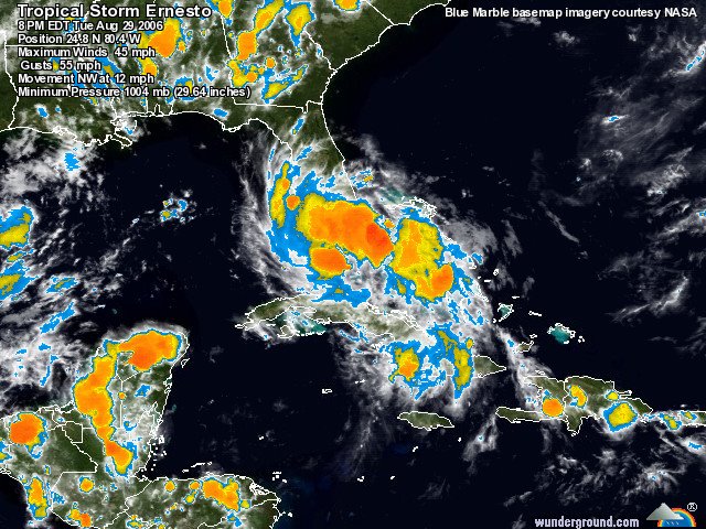
What’s the outlook for Ernesto? According to Dr. Jeff Masters of Weather Underground, Florida landfall will be “followed by a 1-day long plus passage up the length of Florida, followed by a re-emergence into the Atlantic on Wednesday night or Thursday morning. Ernesto will re-intensify over water. If the storm stays close to shore and makes landfall in South Carolina, it will probably come ashore Thursday night as a tropical storm. . . . If the storm moves more offshore and makes landfall near the Outer Banks of North Carolina, it has extra time over warmer water, and will probably be a Category 1 hurricane. . . . The models differ markedly in what direction Ernesto will go after landfall, with several models taking Ernesto up the coast into New England, and several northwest into Ohio.”
(Image: Weather Underground)